
Turning Climate Data Into Decisive Action
Communities and critical infrastructure operators face intensifying threats from wildfires, floods, hurricanes, and water contamination. Legacy forecasting systems provide broad, generalized alerts but not the asset-specific, actionable intelligence decision-makers need when minutes matter.
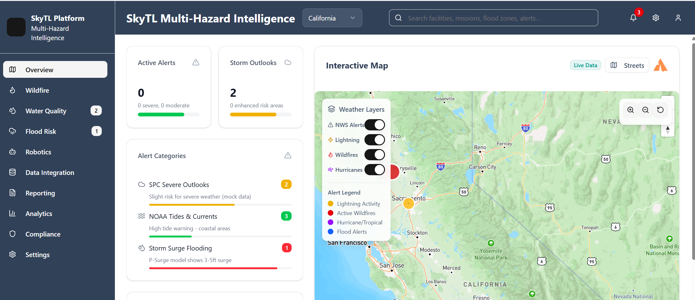
SkyTL fuses multi-sensor data, hybrid physics + AI models, and autonomous robotics into one cohesive platform, delivering real-time, asset-level insights. The result: faster, smarter decisions that help predict emerging threats, prevent unnecessary disruptions, and protect critical assets.


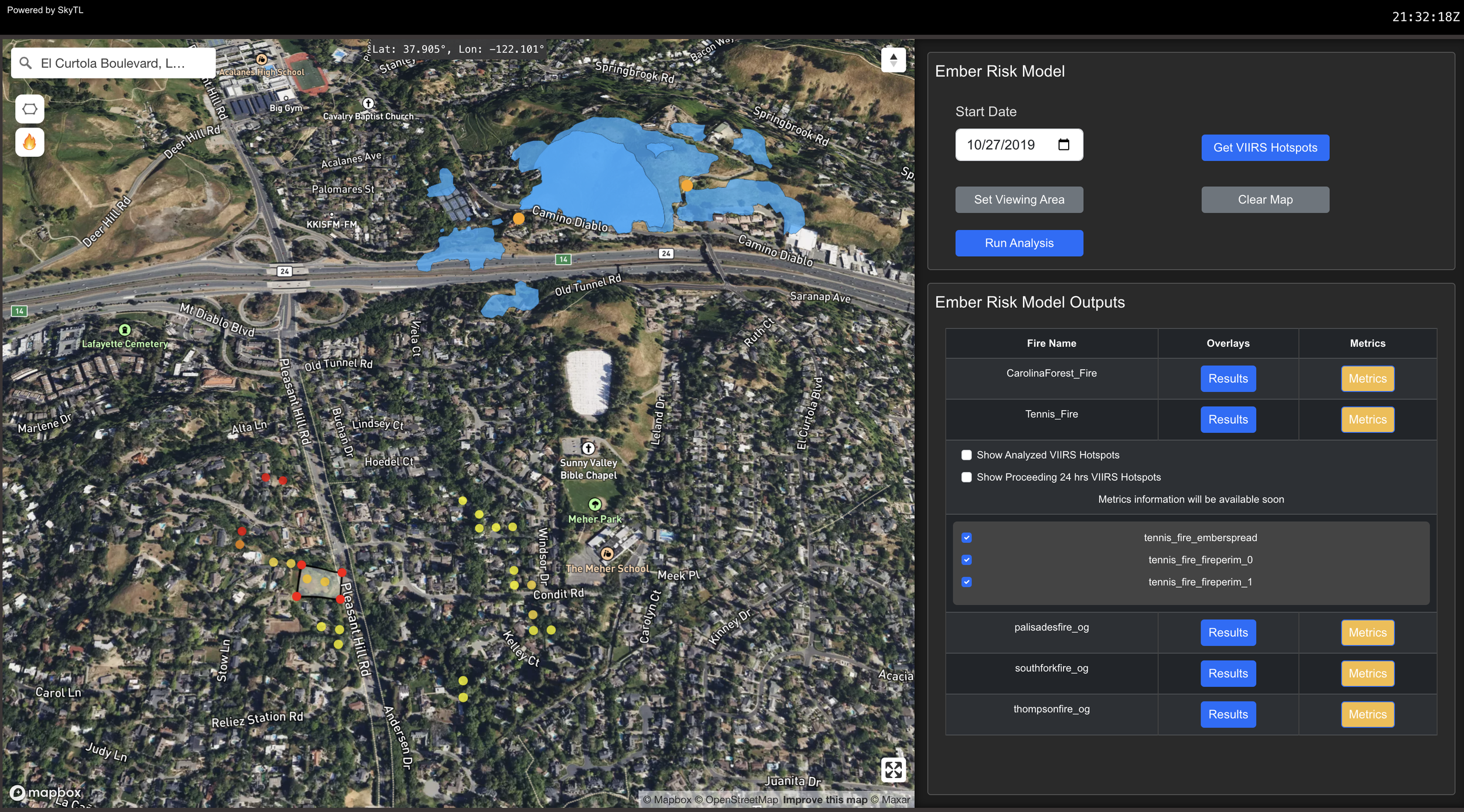
SkyTL’s wildfire intelligence module combines advanced fire-spread modeling, satellite imagery, and drone reconnaissance to deliver neighborhood-level forecasts.


WindTL Success Stories
WindTL delivers real-time, AI-driven wildfire insights to help utilities, fire agencies, and insurers. Take a look at our most recent success stories.
July 2025
WindTL Predicts Fire Spread from Real-Time Aerial Mapping
How WindTL pioneered the first commercial use of in-flight fire mapping to predict fire movement in real time, delivering critical wildfire intelligence with unprecedented speed during high-stakes wildfire events.
March 2025
WindTL reconstructs fires to resolve disputes and guide future mitigation.

June 2025
Fire spread and ember ignition risk modeled. Link here for the report.
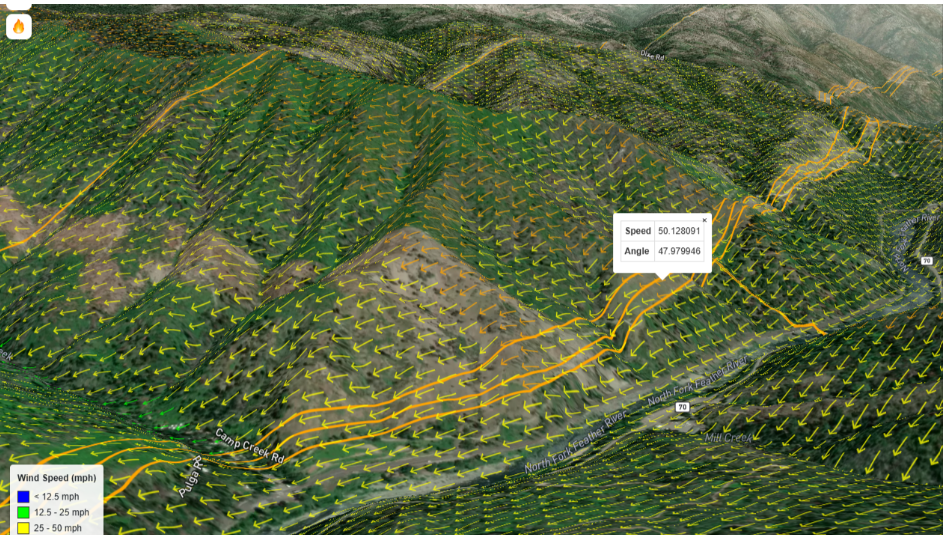
July 2024
WindTL forecasted the Thompson Fire’s embers jumping the river hours in advance

Water Quality Management
SkyTL’s Water Quality Management Module delivers proactive monitoring and rapid decision support for contamination threats.
Flood & Hurricane Risk
SkyTL’s Flood and Hurricane Risk Module transforms complex, multi-hazard data into clear, actionable insights.
Ingests river gauges, radar, and tide data
Provides asset-level inundation and wind forecasts with uncertainty bands
Recommends resource pre-positioning, continuity planning, and safe operational windows
