
The Multi-Hazard Platform for Climate Resilience
SkyTL brings wildfire, flood risk, storm impact, and water quality insights together in one platform. Through risk mitigation tools, aerial operations, and robotics, SkyTL uses advanced sensing and AI-driven analytics to turn climate data into decisive action, helping you predict, prevent, and protect.
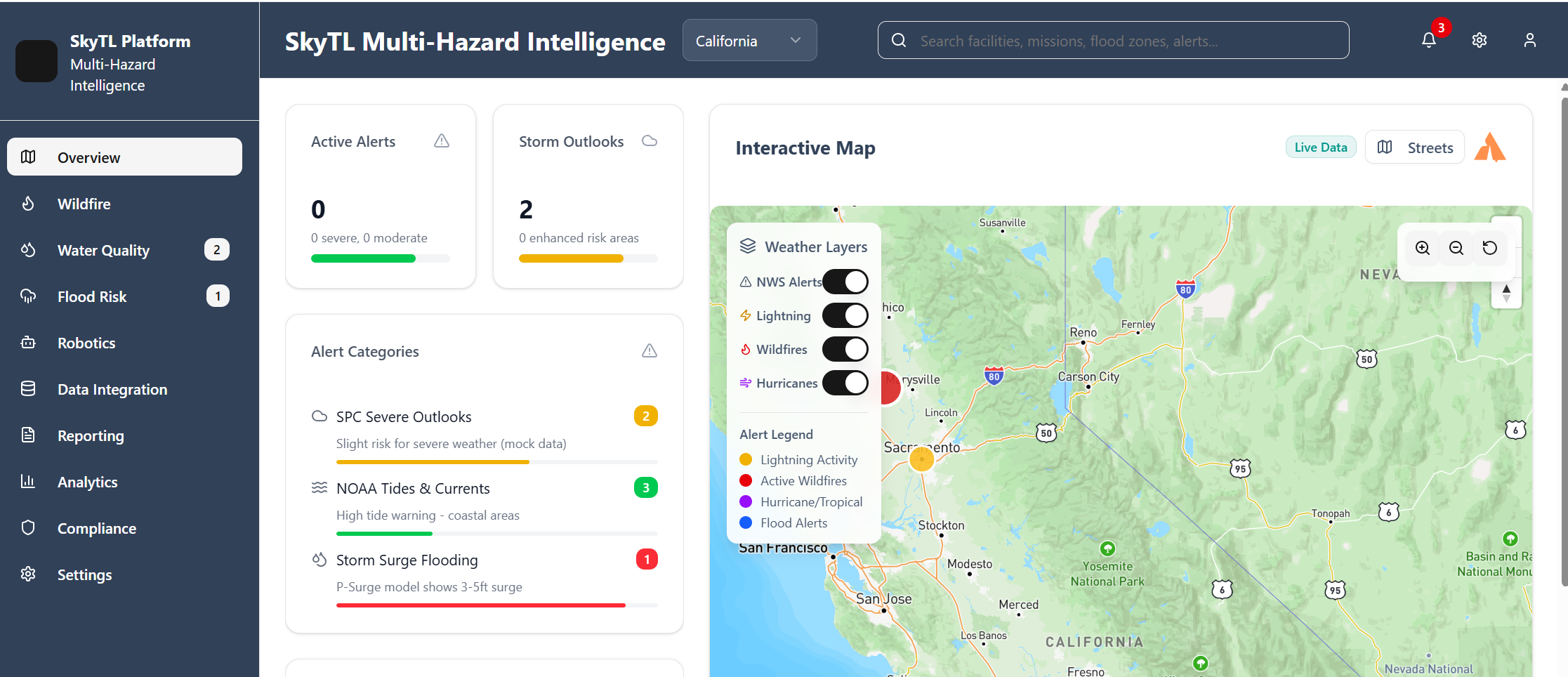
How the Platform Works
SkyTL delivers the clarity decision-makers need when every second matters:


Multi-Hazard Modules
Wildfire Intelligence
Turn Wildfire data into decisive action
Early Detection: Spot ignition points within minutes
Spread Modeling: Forecast fire growth by wind, fuel & terrain
Risk Forecasts: Identify at-risk assets and communities
Response Modeling: Simulate suppression and evacuation strategies

Water Quality Management
Safeguard water systems before crises hit.
Monitoring
Forecasting
Vulnerability Mapping
Actionable Alerts

Flood & Hurricane Risk
Predict and prepare for rising waters.
Data Integration: Radar & tide inputs in real time
Asset Forecasts: Site-specific flood & wind predictions
Response Guidance: Pre-position crews & protect operations

Asset Mission Management
Coordinate missions with precision and safety.
Delivered real-time coordination and responder tracking that enhanced situational awareness and improved safety during complex rescue operations.